Kyushu
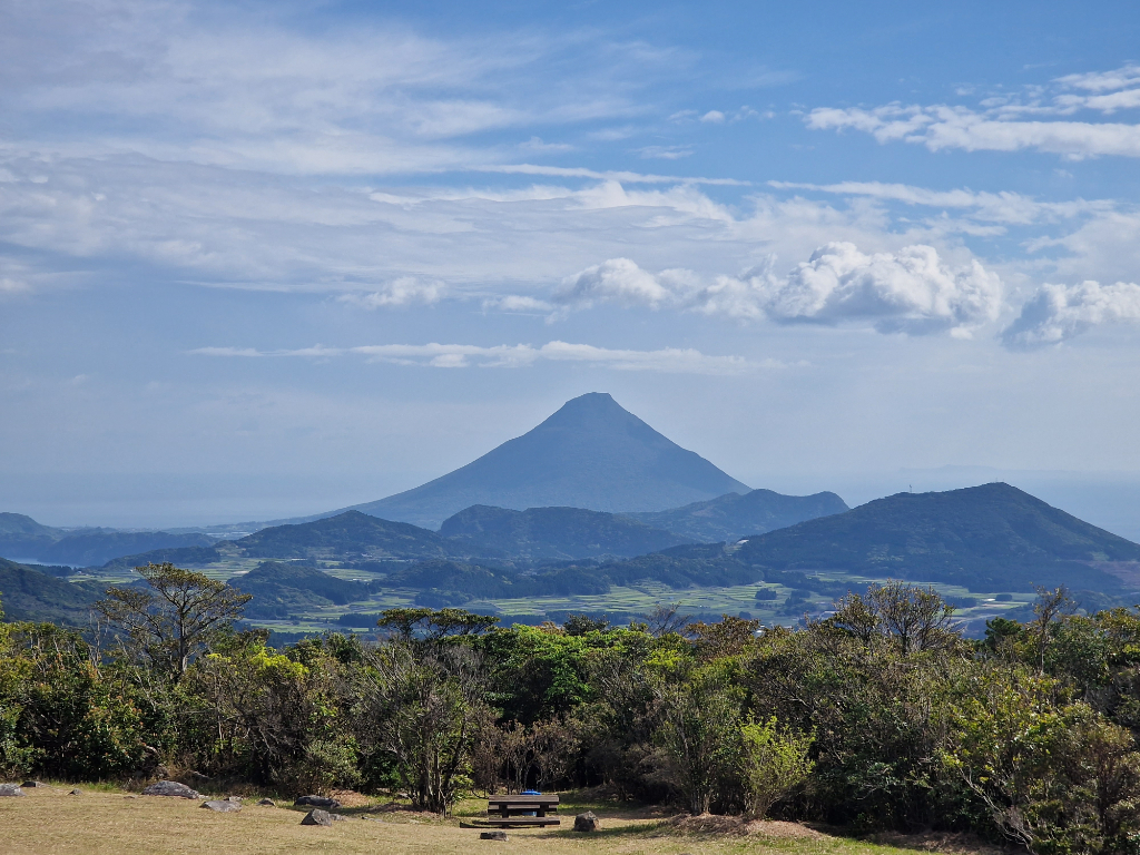 Kaimondake, one of many volcanos in Kyūshū
In the spring of 2023 I travelled back to Japan to have my first bikepacking trip outside of Norway, and my first long bike trip! I’ve never cycled for more than three days straight, so my two week plan was quite a step up! Originally I had planned to cycle in Hokkaido, but while researching bikepacking routes I discovered that it would be quite cold cycling so far north. Going further south sounded like a good idea, and Kyūshū looked really promising.
So with Kyūshū as my destination I started searching for routes and looking at maps. I quickly found out that Cape Sata is a good starting point, as it’s the southern most point of the main Japanese islands. So starting from there I quickly mapped out a route going north all the way up to Kitakyushu. While mapping the first version of the route I found interesting points on the way, and learned about Yakushima. Yakushima looked like a beautiful island for cycling and hiking! Factoring a couple of days for Yakushima, and cycling the last bit till Kitakyushu, Beppu seemed like a better goal for my trip.
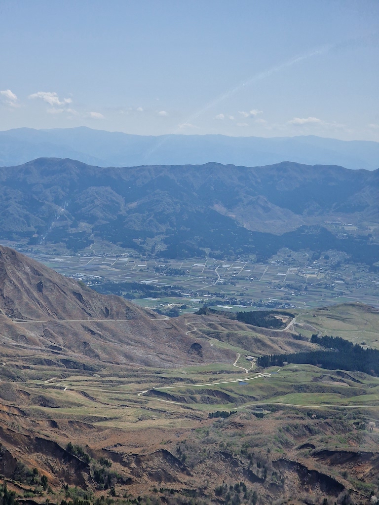
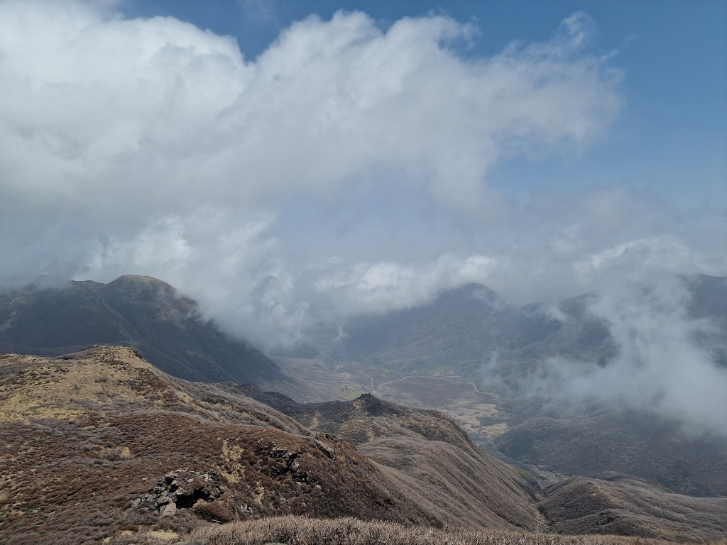
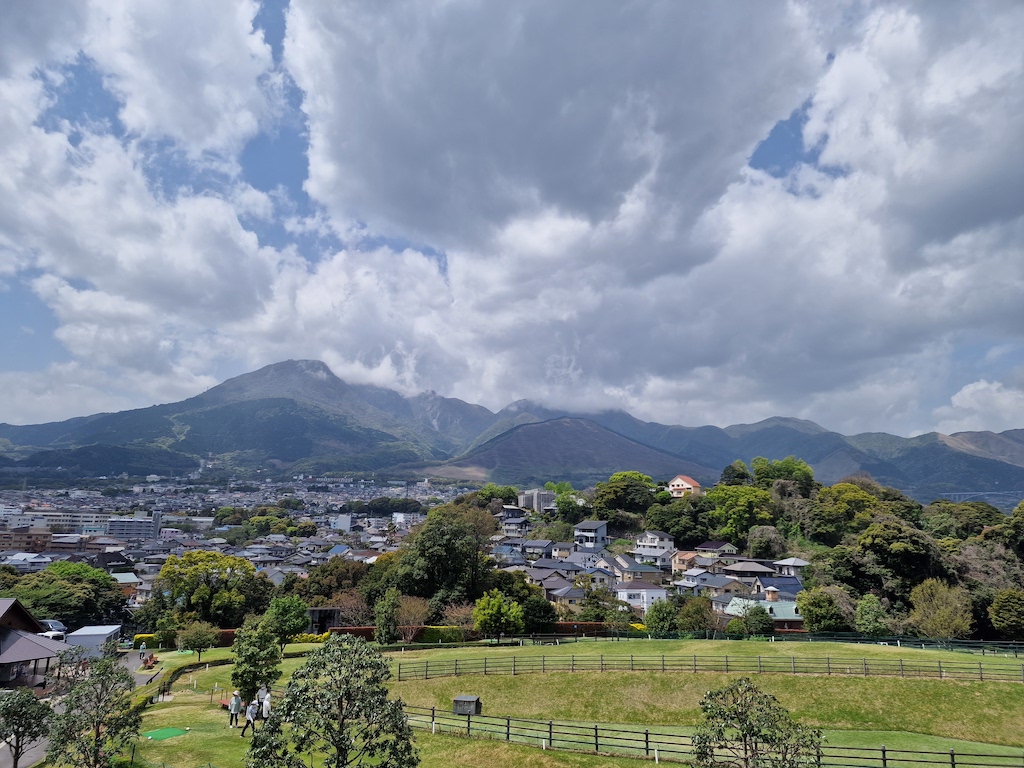
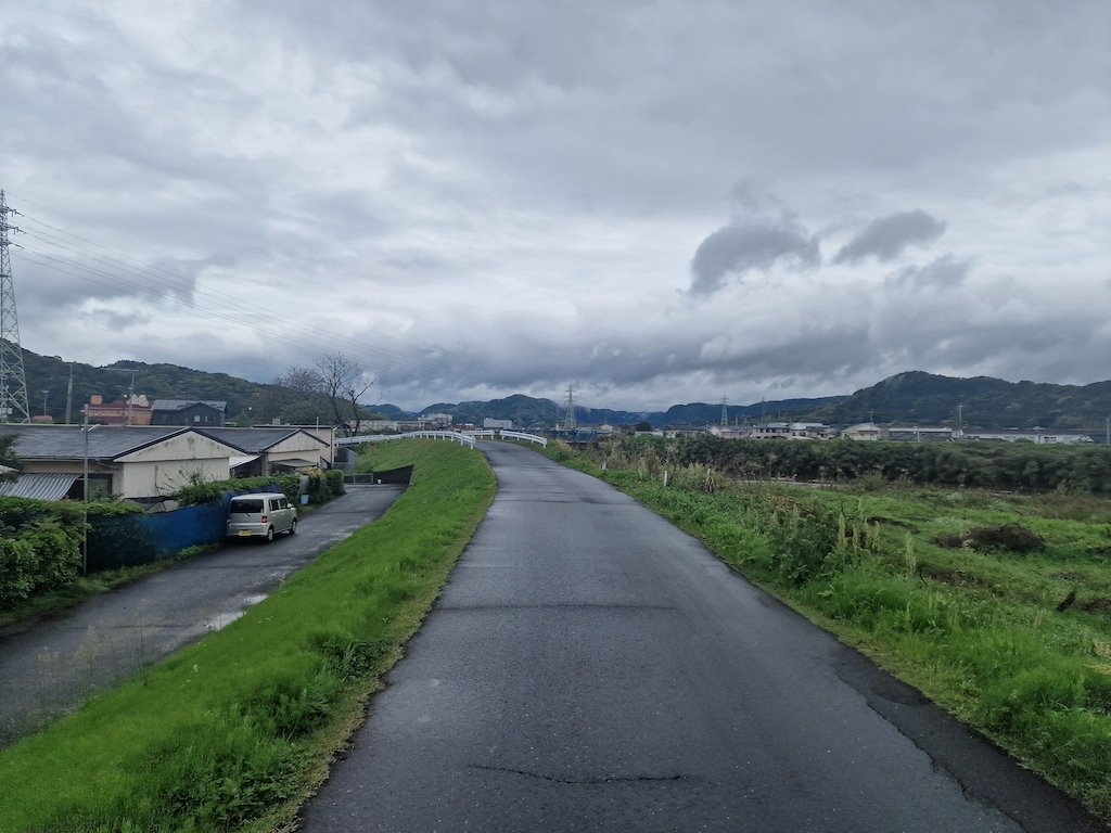 On the road to Ebino plateau, after staying a whole day inside the hotel in Kirishima
It turns out it is easier to plan a trip than to go through with it! I was checking the weather every day the last week before my trip, and it really didn’t look promising. So on my stopover in Tokyo I decided that I’m not cycling Yakushima this time, but cycle directly to Cape Sata from Kagoshima. I’m glad I did this, as it gave me more time on the main trip. Making it possible to plan more for the weather.
Verdict (TL;DR)
This was a fantastic tour! Kyūshū was a really beautiful place to bike in, nice people, good weather, and safe roads. I’m already started thinking about going back next year. I want to finish what I started, visiting Yakushima, sweat my way up Mount Kunimi, and maybe explore Nagasaki and Saga.
It is hard to plan for everything for such a long route as this was, and I’m glad I didn’t have more planned. There is always something interesting to see on the road, and I needed the time to be able to stop to explore.
 You can spot Sakurajima in the distance
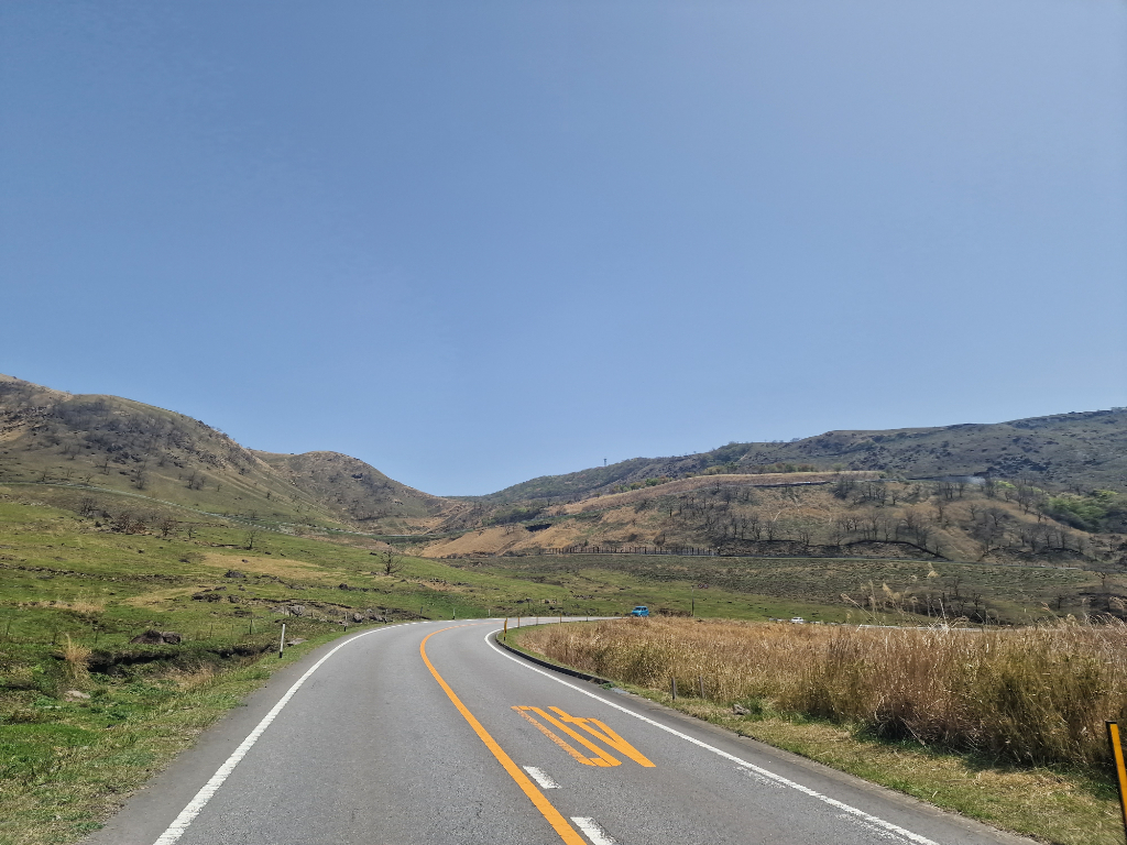
The mountains was also really nice to cycle, and gave me a lot of small roads with very few cars. Going in the off-season was also a good choice with fewer people in general.
Would I do it all over again, yes! Hopefully already next year.
The route
The original route (on RideWithGPS)
I used RideWithGPS.com to plan my whole route. Instead of making the perfect route from the beginning I made several different routes. Starting big, and then narrowing it down for a more realistic route. The original plan was to bike around Yakushima, and all the way from Cape Sata to Beppu, but as you can see, I skipped Yakushima and some other parts on the way.
Transportation
My original plan was to fly down and take the Shinkansen back to Tokyo, but bringing big luggage on the Shinkansen looked like too much hassle. It was also cheaper to book a flight early, and a lot easier with luggage. So in the end I flew down to Kagoshima, and returned to Tokyo from Oita airport.
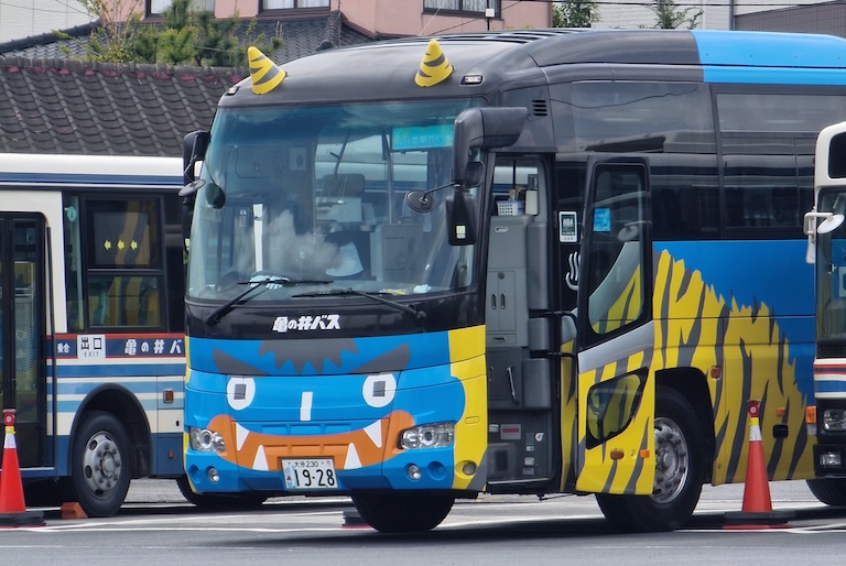 There is a lot of cool buses in Japan
Challenges
My biggest challenge, or hurdle for the trip was finding vegetarian food in the more remote areas of my trip. The convenience stores always have a selection, from egg sandwich (tamago sando), bao buns, to onigiri. Usually I ended up looking for Indian or Western food like pizza. Asking for vegetarian in a local Japanese restaurant often didn’t lead to any success. Breakfast at hotels was usually easier, as they had buffet where I could usually grab vegetable dishes without the meat. Plus, there was always miso soup, and bread and jam.
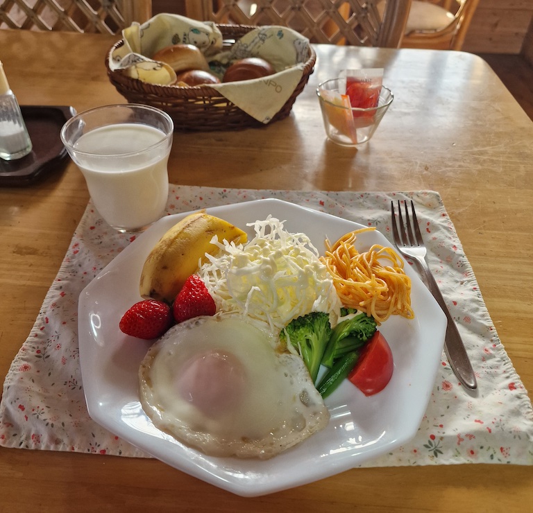 Home cooked breakfast at Kuju Aid Station
The challenge with finding vegetarian dinner also made tenting a little bit harder, as I didn’t bring my camping stove to make my own food. So I was dependent on either eating before tenting, or being able to cycle to a restaurant after pitching my tent.
Other challenges on my trip was discovering that a lot of restaurants are closed in the middle of the day, so if I wanted a better lunch than convenience store food, I needed to have that planned. Also, a lot of local sights close around five (17:00), so I usually needed to visit them before I arrived at my place to stay for the night.
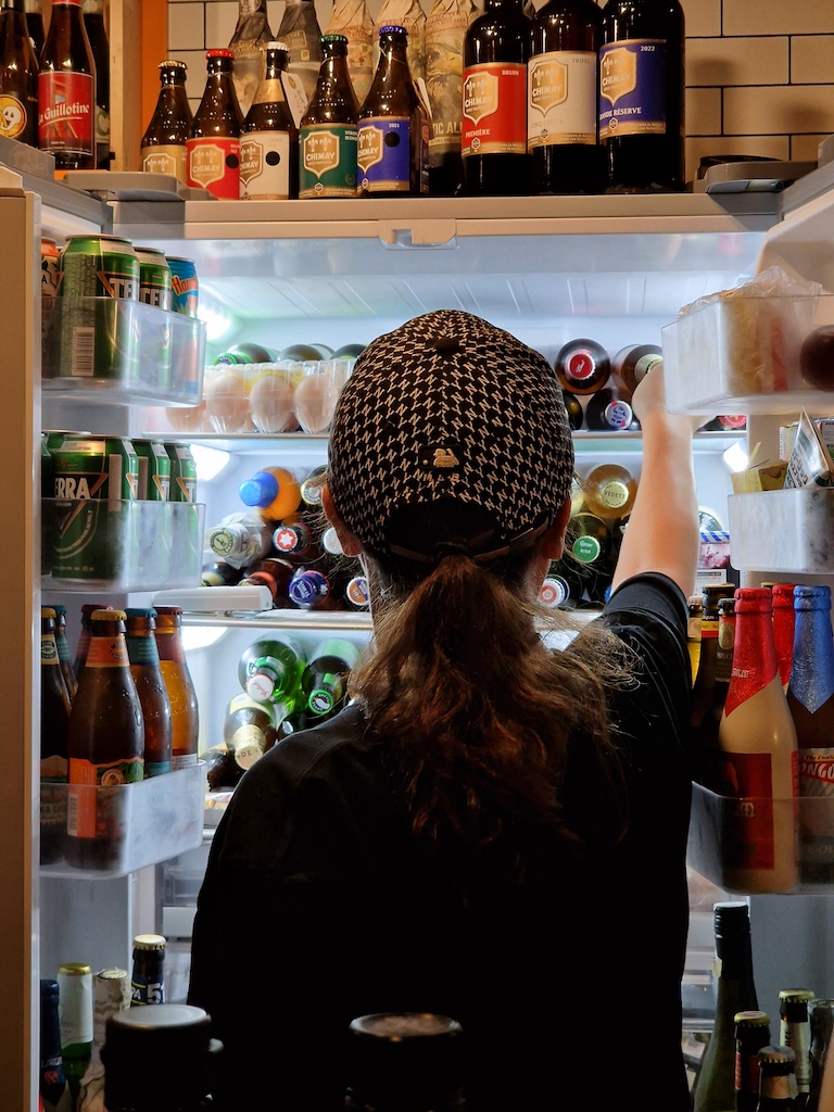 I can really recommend Beer&Pickles Satsuma in Beppu
My last type of hurdle on the trip was mainly me not reading a sign, or ignoring a closed road, as some roads where taken by landslide, typhoon, or earthquake. Twice, on the same day, I experienced that the road or a bridge was destroyed. I could have avoided the last one, if I had translated a road sign instead of gambling that it wasn’t anything important, as only half of the road was closed. This resulted in me first cruising down 3km, and then cycling back up again, in the rain.
What I’m happy I did
I’m really glad that I took some days to hike in between all the cycling. Especially the full day hike in Kuju mountains was really nice. You could go for a shorter route up to Kujusan, or decide to hike all the small tops in the vicinity. If that isn’t enough, you could always choose to hike down to Chojabaru Visitor Center, as I did.
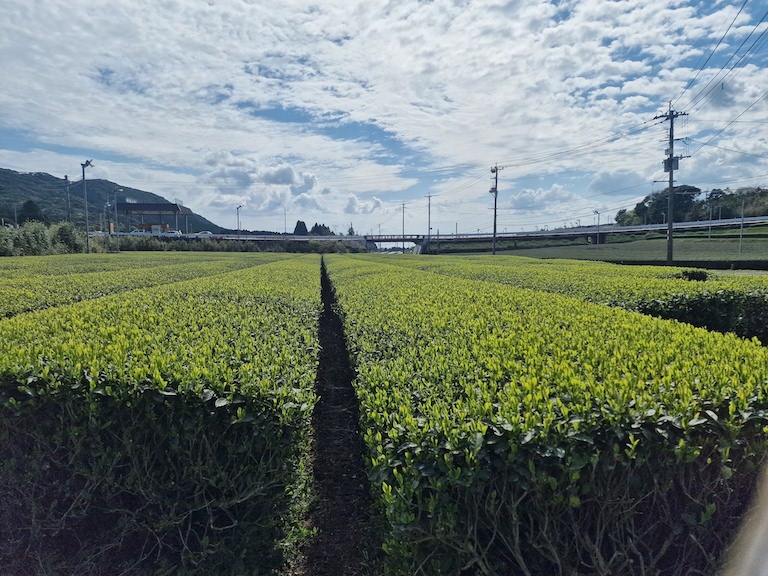 I’ve never seen tea plants in real life, took some time before I understood what it was
I also recommend planning for shorter cycling days, so that you have time to get off your bike to explore, and arrive early at your stay for the night. I’m also really happy that I visited an onsen nearly every day of my trip! Arriving tired and cold, either at a campsite or hotel, and then going to visit an onsen afterwards was really relaxing! It’s also a good way to clean of all the filth from the day.
PS: Remember that public baths/onsen don’t have free towels, so bring your own (or buy it there).
Essentials
I’m pretty pleased with my gear for this trip, and I feel like all the shorter trips I’ve been on before had prepared me for this. I ended up moving some of the items around during the trip, when I found it fit better in a different bag. I also doubled up on cycle tubes (I was riding tubeless), and cycling shorts, both of these I’m pretty sure were unnecessary for my trip. Of course you don’t really know when you´re going to get a flat, but I didn’t have any so I felt that having two tubes was a bit much, especially as I always traveled from city to city. Doubling up on the cycling kit was also a bit much, I just made sure to remember to wash it regularly. Either washing it in the sink or, if the hotel had a washing room, a quick machine wash made it good for the next day.
One thing I was missing was a long sleeved cycling jersey, as it was sometimes too warm for a jacket, but too cold for short sleeves. My solution was to use one of the long sleeved wool t-shirts I brought underneath my cycling jersey. Plus some chain oil would have been nice, mostly because I forgot to oil it before I left Norway.
I’ve made a list of my gear at the bottom of this post, sorted by which bag they were in.
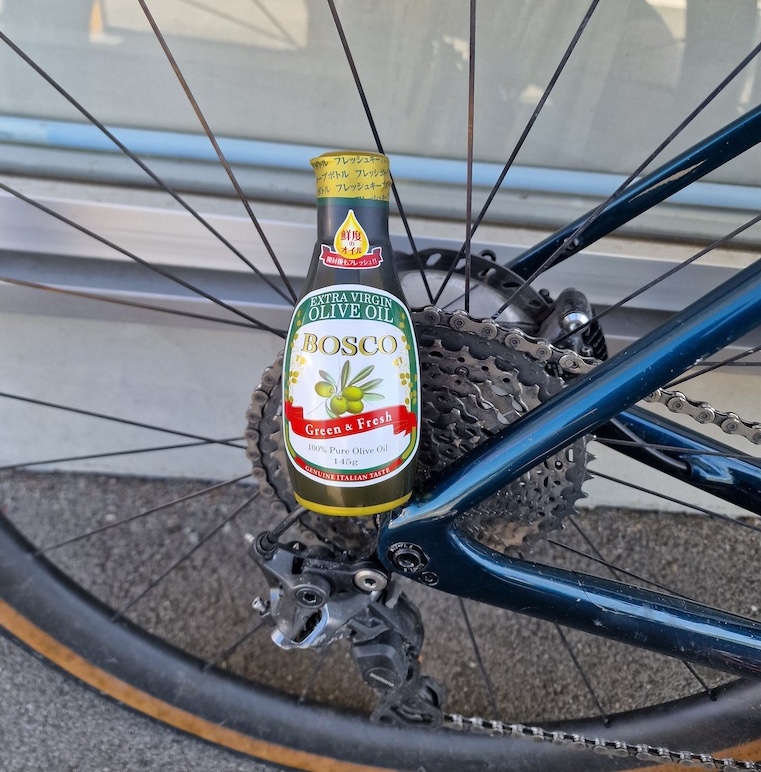 Twenty minutes after I bought the bottle I rode past a Costco
Accommodation
The original plan was to camp every night for my two week trip. I managed two days before I ended up checking into my first of many hotels. The main reason (as mentioned in challenges) is that it was easier to find food near hotels in the cities, as opposed to the camping sites which were a bit outside the cities. Other reasons was the price for campsites compared to hotels, and the ease of staying at a hotel, rather than staying hunkered inside my tent for a whole evening.
 I wished I stayed a night here, I could have biked to it
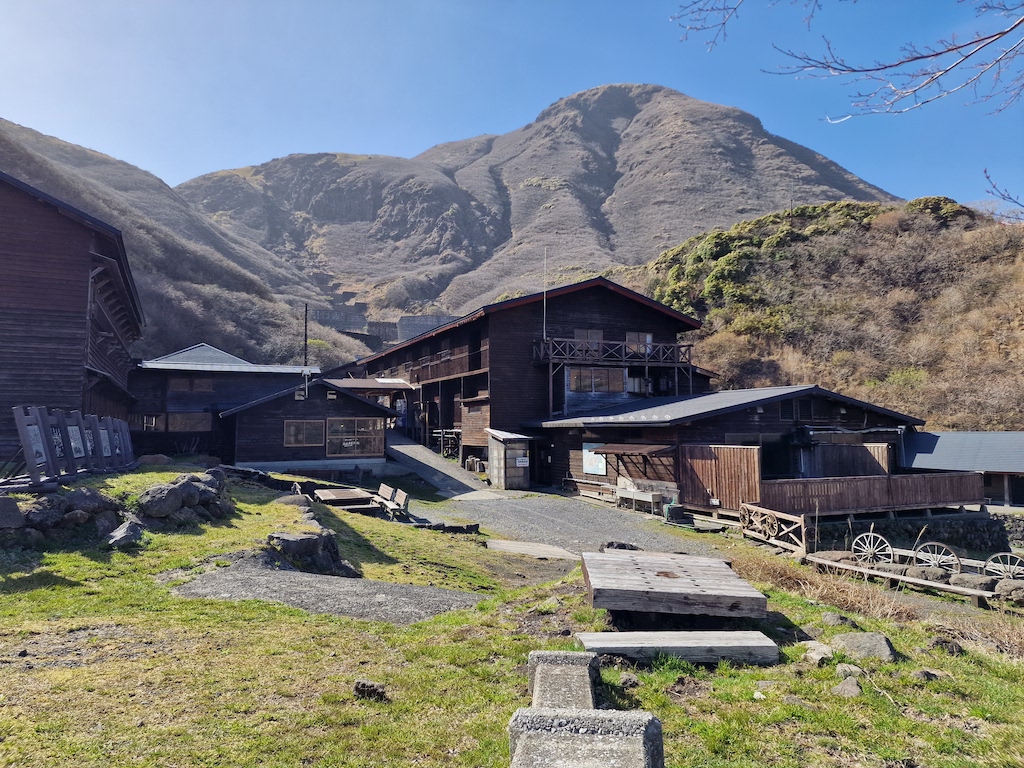
Except for one free campsite both my campsites were ¥4000, and even though the hotels were mostly double that price, I felt staying at a hotel was a better experience and value for money. Even better was the night I stayed at the Aso Base hostel, which was ¥2800 for one night in a shared room. I can really recommend that place, and I bet that hostels in smaller cities will be just as cozy.
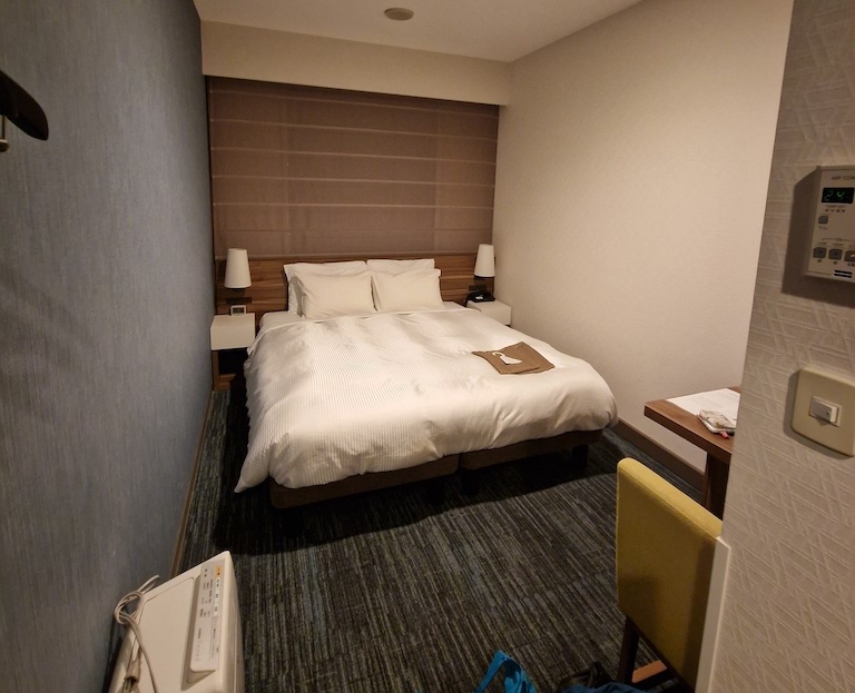 There is a lot of small hotel rooms in Japan, this one is from Kumamoto
What would I change for my next trip
When planning the trip I should remember to take into account that some days I will be tired, or that it might rain too much (for me). In short, I need to plan for some buffer days. On this trip I had one whole day at a hotel early on because of the rain, but this ended up being a good thing since I was tired. I also arrived two days earlier than planned to my destination, which meant I kinda had three buffer days. Three days is a bit too much - I think two days will work, if I also plan for some easier days along the way. Most of my short days had either a long day of hiking or a steep hill to climb.
 I detour downhill to find this shop, to no avail
Arriving two days earlier than first planned in Beppu meant that I had to “sit” and wait for my flight back to Tokyo. Not sure if booking the flight in advance was the best use of my time. That may just be me being restless. Because of the wait, I did get to see and experience Beppu after all! The main problem was probably that it was too expensive to stay in the hotel I had booked in advance, so I had to change hotels. Not sure what I will do here for my next trip.
What I am pretty sure I’ll skip on my next trip is camping. Camping in Kyūshū in April wasn’t as warm as I had predicted. Mostly when I’ve been bikepacking in Norway I end up biking the whole day, so when the tent is pitched I would just go to sleep. On this trip I was often at the camp site around five or six, with plenty of time left of the night for some local sightseeing or reading my book. When the weather is nearing 10 and below, it’s not that nice to sit outside and read, meaning I ended up hunkered down in my sleeping bag. I already feel like I do that too much on my local trips back in Norway, so I don’t want to spend my time doing that on these types of trips. Maybe If I had traveled later in the season this wouldn’t have been an issue at all. My night south of Mount Aso was really cold, I had to put on all my clothes during the night to avoid freezing! Next trip I’m probably going to plan it with hotel stays in mind. I’m also going to save a bit on weight too if I skip the camping equipment.
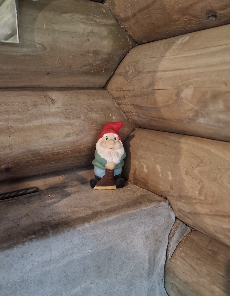 I’m pretty sure this is a Norwegian nisse (house goblin)
I also need to remember that luggage storage may close before my plane lands, so always double check. This time I ended up bringing my bike to my hotel in Tokyo, and then having to travel back to the airport to get it stored the day after.
Trip report
Day 1, 63km, 1300m - Biking the Ibusuki skyline
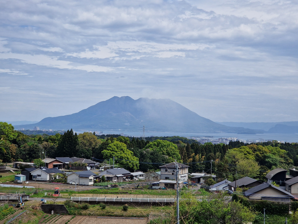 Sakurajima, the first volano I saw in Japan
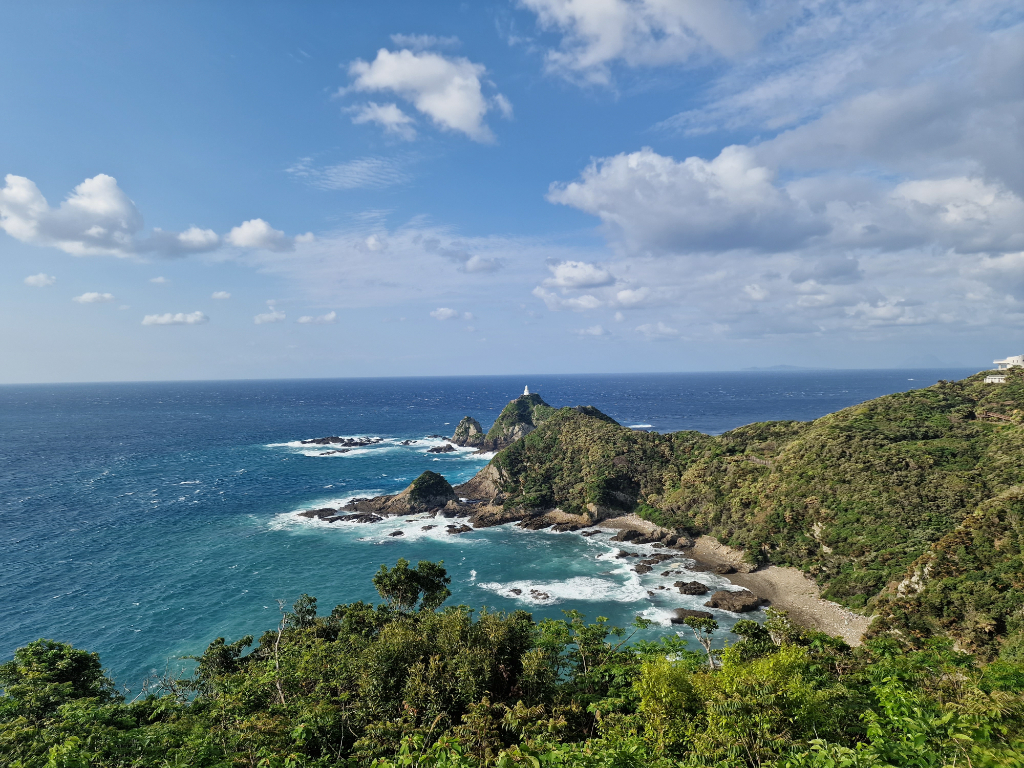
My trip started sunday April the 2nd from Kagoshima, which is south in Kyūshū. The goal for the whole trip was to bike from Cape Sata in the south, all the way to Beppu in the north. First I needed to get down to Cape Sata, so I cycled the scenery skyline down to Ibusuki. The Ibusuki skyline has several beautiful sightseeing spots towards the Kagoshima Bay and the Sakurajima volcano.
My first day of biking ended at a camping ground at the shores of Lake Ikeda, with the Kaimondake volcano as my backdrop. I hadn’t planned for dinner, so I didn’t make the closing hours of the local restaurant. Luckily they had some tofu and rice in the camp store, so I managed to get a basic meal.
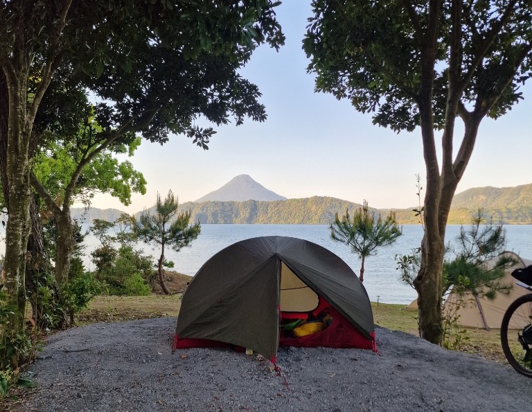 Camping with Kaimondake in the background
Day 2, 65km, 780m - The ferry over Kagoshima bay
My second day turned out to be a real sightseeing day! I visited my first onsen on this trip, where I also experienced sand bathing. The sand near the onsen is naturally heated, so they burrow you in the sand for 10 minutes. It was a fun thing to try out, but I do enjoy a regular onsen more. Luckily they have both.
 Old remains of Ibusukibashi-Muregawa
After the nice relaxing bath I took the ferry over the bay to Minamiosumi. There where a lot of eagles near the coast, and all the way down to Cape Sata. I had personally never seen that many eagles, and especially not that close. One landed less than 5 meters in front me while I was biking! It quickly took flight when it understood that I was riding towards where it landed. So this was a really good start for my trip.
I camped at the Sata Misaki public campsite, saving the trip to the tip of the island till tomorrow. It was a really quiet place to camp, as I was the only one staying there, and there was only one light lighting up the entrance to the toilets. So it got pitch dark, a bit surreal, since all you could hear was the wind blowing and the birds chirping.
Day 3, 90km, 1500m - Heading north
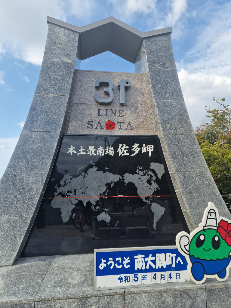 The 31 degree north mark
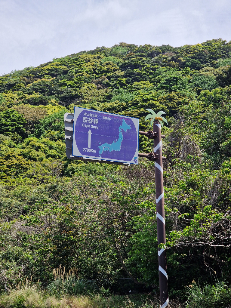
It was first on the third day the trip finally headed north! I started the day by visiting Cape Sata and looking out towards the sea! There was also a sign on the way back telling me it was 2600km to Cape Soya! Hopefully one day I will have biked all they way there.
 The southern most point, I got as close as was allowed
I decided to have a little detour on my way to the camping site in Kanoya. The goal was to see a waterfall, but I used Google Maps to find it, and it took me to the top of the waterfall instead of the entrance. Meaning I couldn’t see it from the bottom, as the entrance was too big of a new detour.
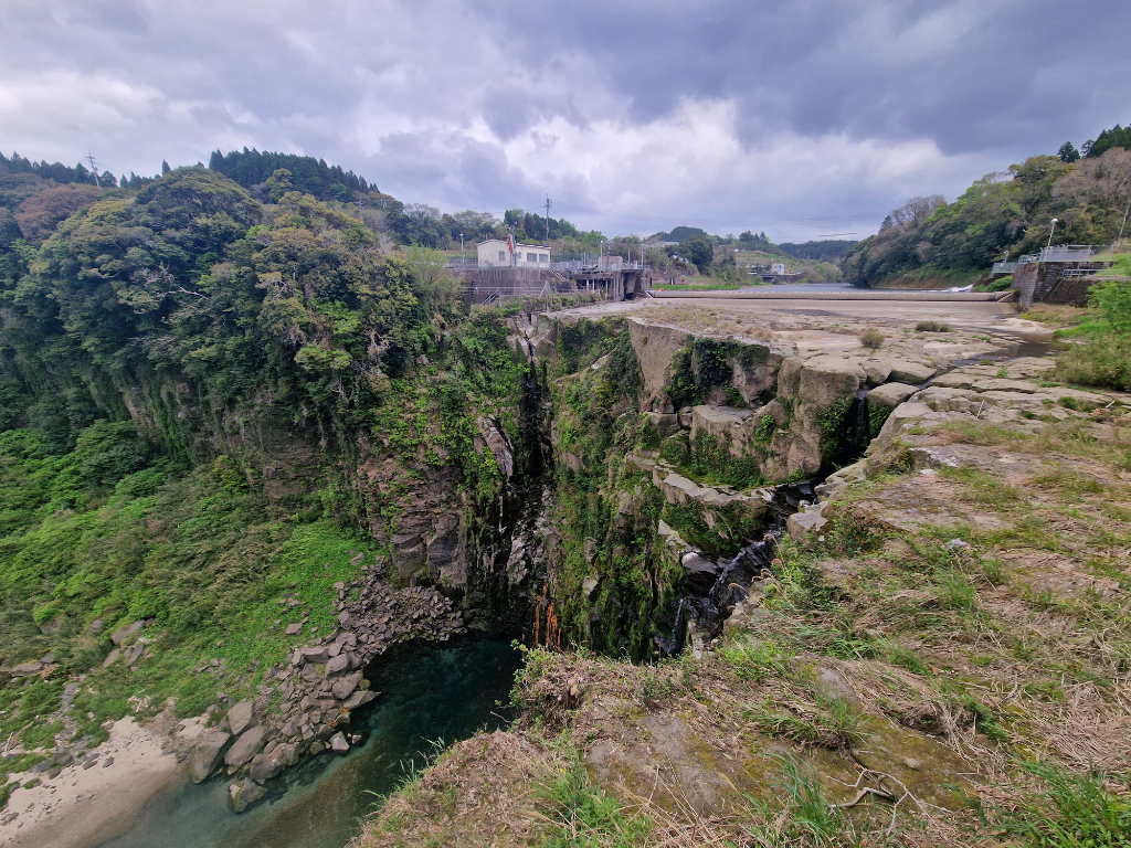 It would have looked more impressive down in the valley
The plan for this night was also to camp, but again I hadn’t really researched restaurants around the camp site. It turns out the camp site was on a small but steep hill, with no restaurant nearby. This meant I would have had to ride down to find some food and visit an onsen, and the get back up the hills again afterwards. It also didn’t help that the camping site hadn’t opened for the day when I arrived. So instead I went to a bike friendly hotel, which also had its own onsen! This turned out to be a trend of my trip, using hotels instead of all the camp sites I originally had planned.
 Hopefully one day I will reach Cape Soya
I also tried my luck at finding a vegetarian-friendly restaurant. Even though I didn’t find one that had vegetarian food on the menu, they did manage to cook me something I could eat.
Day 4, 87km, 1700m - Over the mountains and closed roads
The fourth day was going to be a long and hard day. Instead of riding straight to Kirishima to avoid the rain, I was determined to follow my original route going over mount Onogara. I didn’t know much about the route, as the photos on Google Maps were quite old, but it looked doable. The day started cloudy, and it began to rain halfway up mountain. I took a short detour to visit the Narunoo Ranch and to go to the bathroom, as I didn’t want to risk going in the forest. It was a good choice as there weren’t any toilets well past getting down the mountain on the other side!
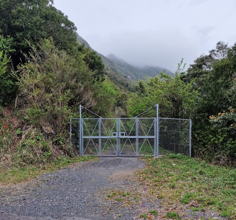
The first hurdle on this route was the locked gate blocking the road I wanted to take. Luckily the fence ended at the side of the road, so I managed to sneak around it easily. There was a reason this road was fenced off, as it had some hurdles on the way. It started off okay, mostly gravel that sometimes turned to big gravel, and some short parts of asphalt.
 The old Google Street view image was just two wooden road blocks
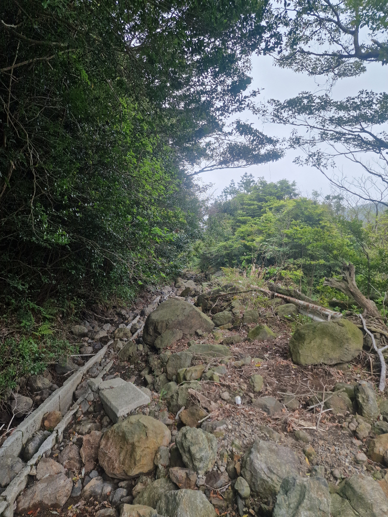
After about an hour with bad gravel I came to where a bridge had been before! Turns out the road was closed because a bridge and the next kilometer of road was gone! Luckily there was little water in the new river, so I managed to cross by lifting my bike up on to some old concrete blocks. As I wasn’t keen to turn back around After that I just had to hike the bike through the worst road I’ve ever ridden!
 Not much of the bridge was left
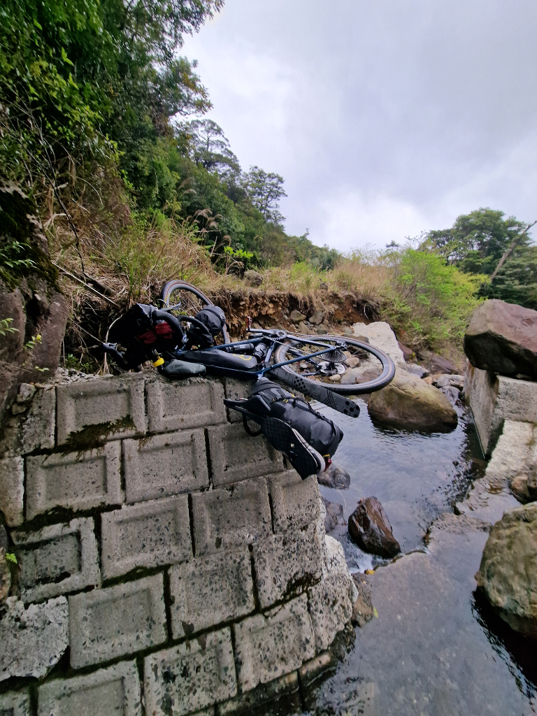 I managed to cross the river without getting wet
While hiking I was curious if other bridges would also have been taken by a storm, when I suddenly noticed some clear car tire marks in the mud! This had to mean that someone had driven a car all the way up here from the other side recently. Turns out this was true, and I could ride most of the way back down on the other side! The road wasn’t good the rest of the way, but at least I managed to get down in one piece and could continue on the main road all the way to Kirishima!
 I want to say it wasn’t as bad as it looks, but it was
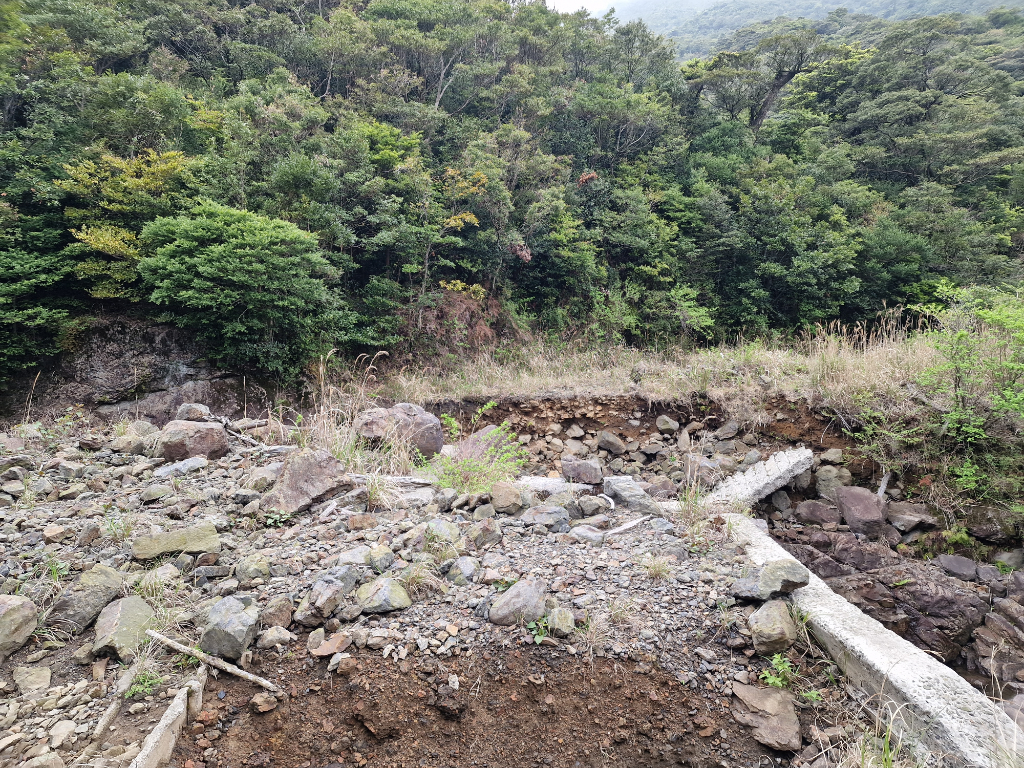
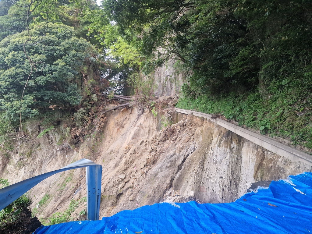
The rain had started while I was heading down the mountain, so I had about 50km left on the main road next to traffic before I would be at my hotel. Biking in the rain next to cars and trailers will get tiring after a while. So when I only had about 20km left I decided to take a little detour on a road going down to a different main road. I hoped to finally get a little break from the cars, but I forgot to double check why half of the road was closed, and ended up cycling down a closed road. This time it was really closed, as the whole road had collapsed and gone down the hill, so there was no way for me to pass. I just had to cycle back up again and follow the main road.
 It was impossible to pass this
After a long day I finally arrived at hotel Kyocera, which turned out to have a church inside of it, with a huge ruby socket into a cross! Sadly I can’t find anything about it searching with English terms.
With the bad weather continuing into the next day I decided to stay here for an extra night.
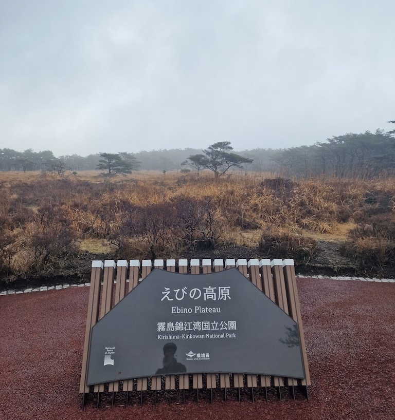
Day 5, 39km, 1260m - Heading up to Ebino plateau
After a complete rest day in Kiroshima it was time to head on. This time the goal was Ebino plateau to visit mount Karakuni. The day started gray with a light rain around 0 meters above sea level, and I was set to cycle all the way up to 1200 meters!
 It was quite chilly on 1200 meters
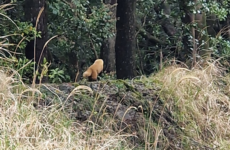
On the way I visited my first foot bath, which was nice. I also got to see three different native animals working my way up the hills! First I saw a small Japanese boar, then a Japanese martens was running next to me for a short while. Right before I was at the top a Kyūshū sika deer jumped across the road!
 It kept stopping to look at me
It was really foggy when I arrived at the top, and getting cold. So I treated myself to another night at a hotel, getting used to this lifestyle.
Day 6, 7km, 500m - Mount Karakunidake and a bus ride
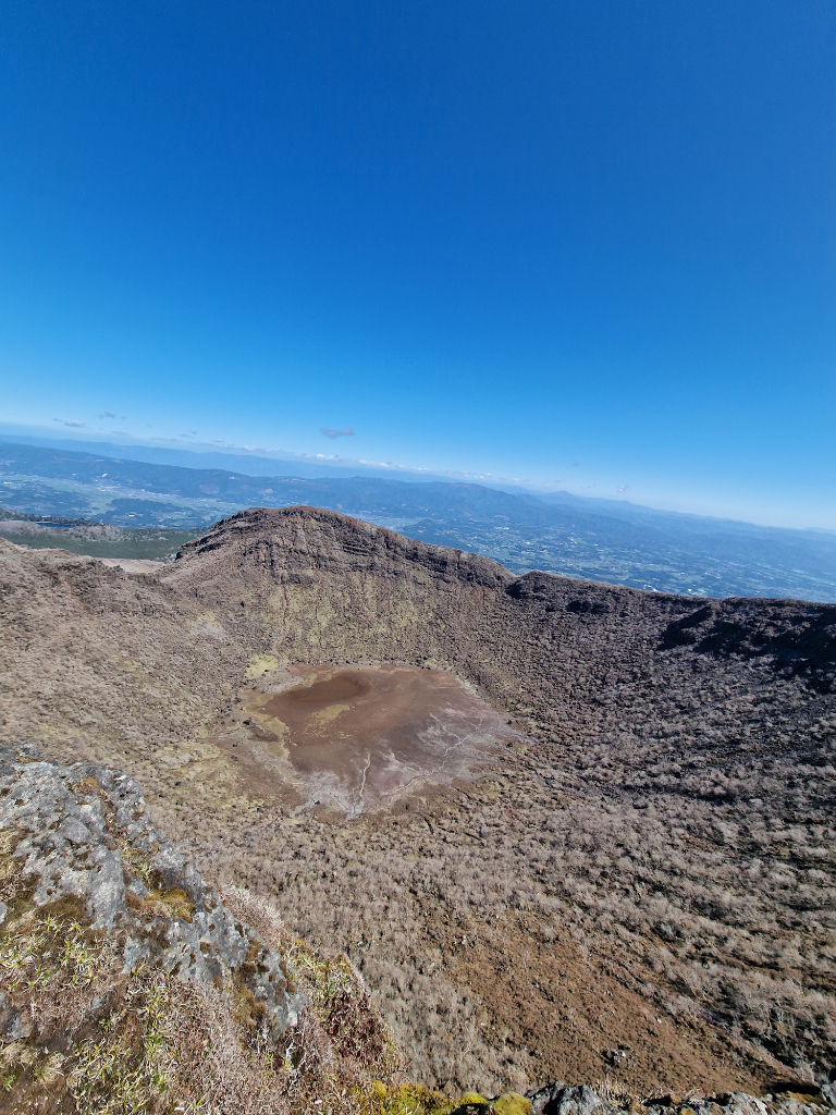
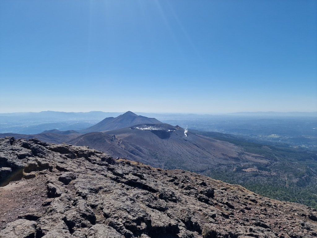
I had put hiking on the itinerary for Ebino plateau. The main goal was to hike all the way up to the top of mount Karakunidake, my first visit to a volcano at a close distance. Karakunidake is 1700 meters above sea level, and is not an active volcano anymore, but its neighbor Shinmoedake on the other hand had an eruption as late as 2011! So I could still see it smoking looking over to it. I had to admire it from a distance as I wasn’t allowed to visit it.
 Not as impressive as I thought it would be
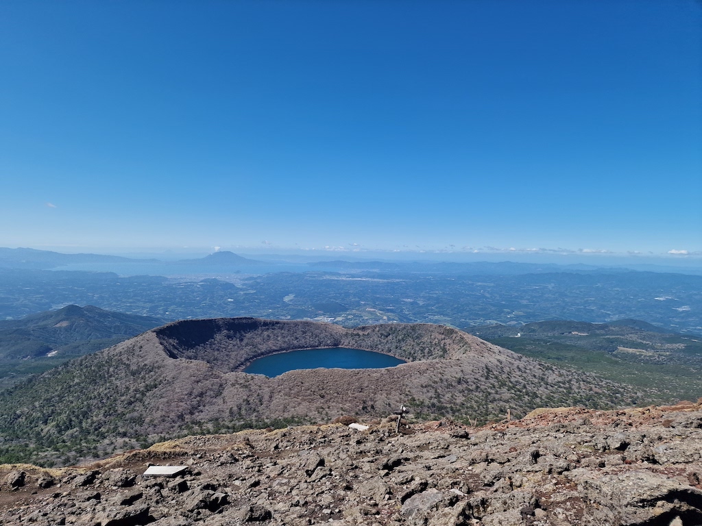
The hike up was pretty easy, but it was a rather windy day. So there was no reason to stay long on the top, even though the view was fantastic. To get a different scenery on the way back I decided to go towards Onami-ike crater, which is full of water. I didn’t go up to the crater, but followed the valley back to the hotel. If I had had more time, I would love to do some more hikes in the area, as it was really beautiful!
 I wish I had more time to hike here
The next goal on my itinerary was to catch a bus heading from Ebino to Kumamoto. The bus would let me skip the next two mountain passes on my way to Yamato, on the other side of mount Kunimi. This was so I would get a better weather window visiting mount Aso and hiking the Kuju mountains. It also helped me save a lot of energy, because cycling over mount Kunimi would be quite a feat. Hopefully I will be back for revenge!
Day 7, 82km, 1400m - Bridges and hills
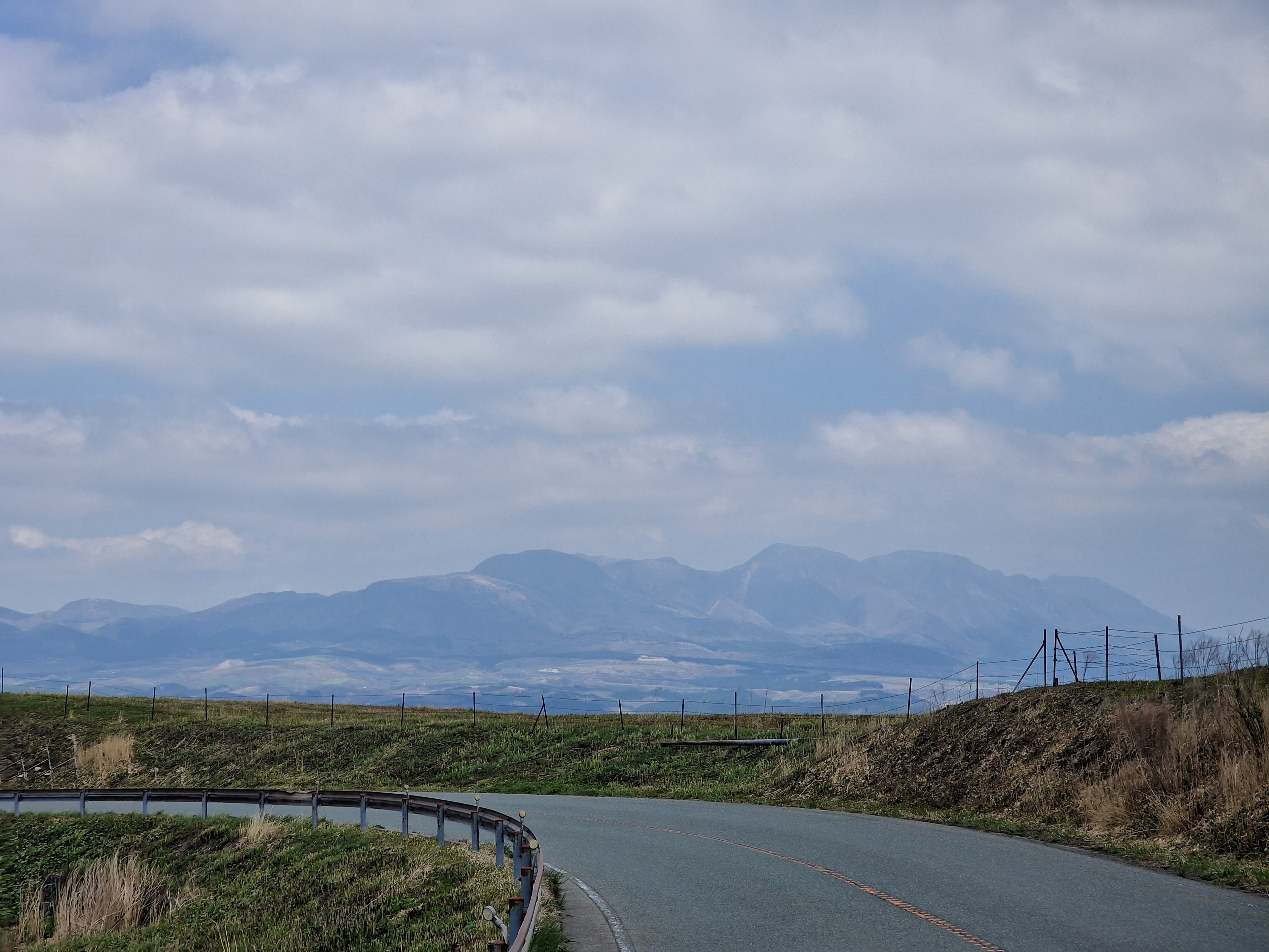
Another long day with more than 1000 meters of ascending! This time I cycled from Kumamoto, to Yamato to see the Tsūjun bridge, before going over Shimizu pass to ride down into Aso. The road to Aso, especially from Yamato, went on quiet and secluded roads with hardly any traffic. I can really recommend road 141 onto 319 going from Yamato to Aso.
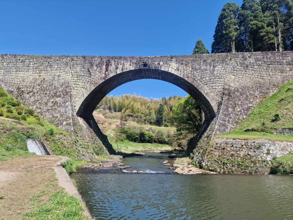 Sadly I was one hour too late to see the water coming from the bridge
It was a pretty relaxing day of cycling, though a long one. I got to eat at an American sandwich bar with huge portions, as Americans do like. After that I visited Tsūjun bridge, which is an important aqueduct bridge for delivering water to the Shiraito plateau. In Yamato where the bridge was they also have a festival called Hassaku where they create these huge wooden sculptures called Otsukurimono in Japanese. They were really cool to look at, so I’m really glad I planned the route through Yamato.
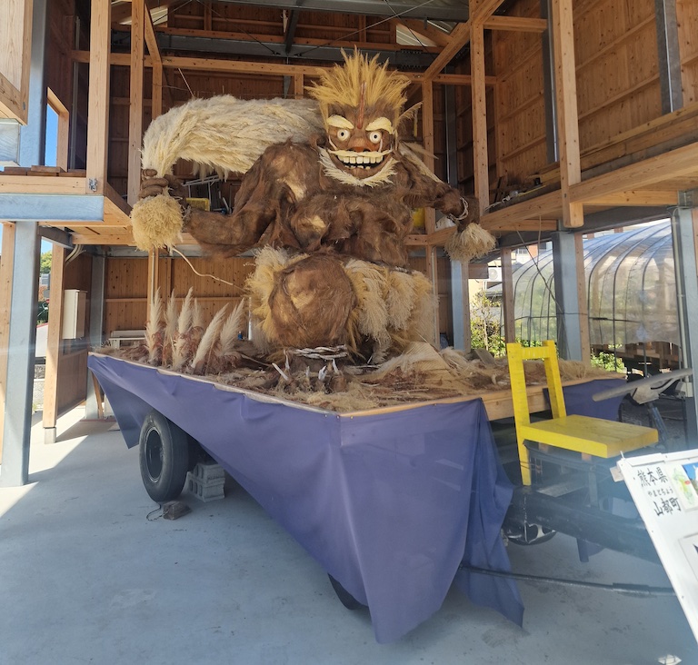 There where a lot of these statues
In Aso, or more precicely Yoshida, I stayed at a camping site, and it was freezing so I had to put on all my clothes to keep warm during the night. The camping site was also a bit far away from any resturants guaranteed to have vegetarian food. So I ended up biking 15 minutes one direction, before heading 10 minutes the other direction for an onsen. Totally worth the back and forth for the pizza and bath!
While riding out of Kumamoto I also noticed the first of many cool designer manhole covers that are supposedly everywhere in Japan!
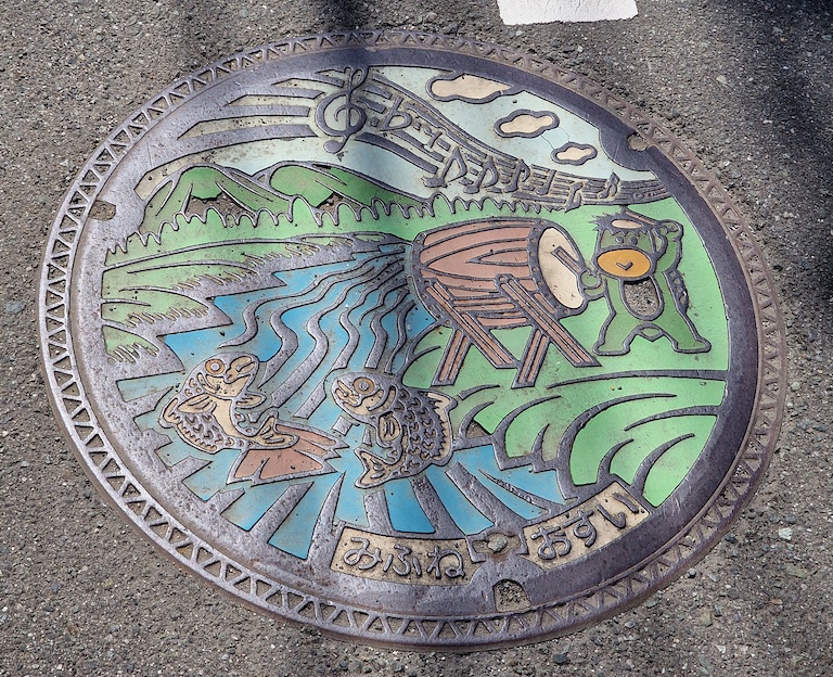 I should have taken more pictures of these covers
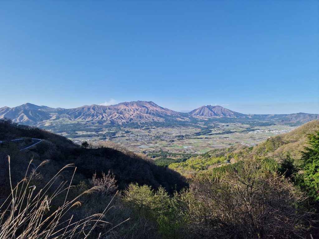
Day 8, 45km, 1000m - Aso Mountain
Aso mountain or Aso volcano lies in a big caldera, meaning that the still active volcanos are kind of inside the “real” volcano. It was pretty amazing yesterday to stand on the edge of the caldera (the Shimizu pass) and look into it!
 Aso mountain from Shimizu pass
The day started with a bike tour to the nearest Lawson (as the FamilyMart was closed, or not yet opened) for some breakfast, before heading up the 700 meters to the volcano! It was a pretty nice road to bike on, with few cars and a good view of the valley. Not too much wind, but still a bit chilly. The last stretch up to the top was a really steep hill, but I got some cheering on from some passersby which helped! Since Aso is an active volcano they have a danger zone, and we couldn’t go all the way out to see the main crater this day. So I had to be happy with the older crater, and just look at the smoke from afar. It was a bit anti-climatic.
 The view towards Shimizu pass from a helicopter
On the way down on the other side I rode past a helicopter you could ride. I wasn’t sure if I should take a ride, and it seemed like a long line too, but while riding past I thought; why not, this is probably the only chance for me to experience this! I am so glad I did it! The helicopter trip was amazing! It started with a long sweep around the whole mountain, so I got a good view of the bigger area and the road I had taken up. Then we headed to the main volcano and I got a wonderful view of the volcano seeing the sulfur pits formed inside.
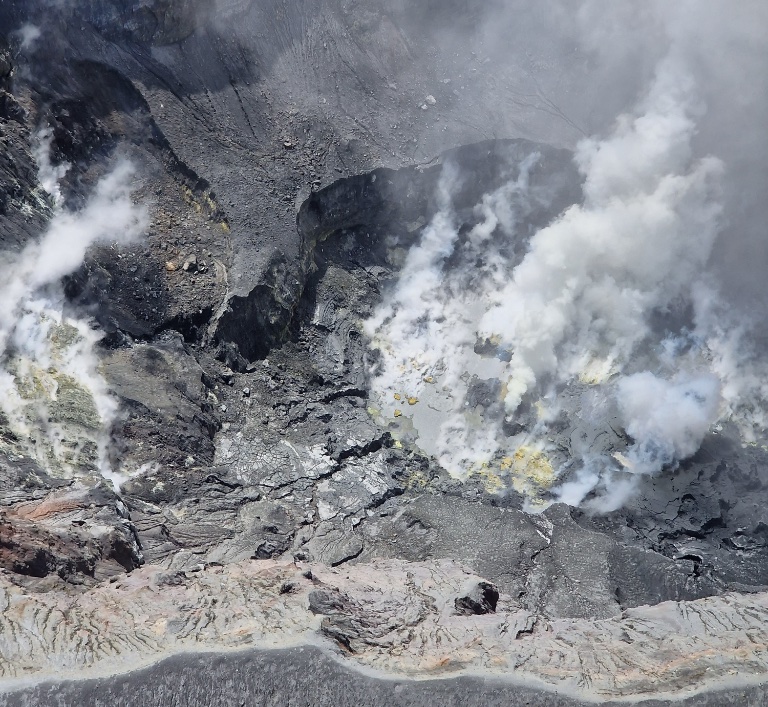 It was a lot more impressive looking inside of the volcano
After the helicopter ride it was time to head down on the other side of mount Aso, down to Kurokawa. There was a lot more traffic on this side, so I was glad that I was not cycling up here.
 The area around the volcano looked like the moon
For the next night I stayed at ASO Base Backpackers, a really cozy hostel. That evening was a bit more social than I was used to, and I got talking to people from Germany, France, China, and Japan. The girl from Japan even gave me some bread that I first thought was a dark rye bread, but turned out to be chocolate bread.
Day 9, 56km, 1100m - To the Kuju mountains
Cycling on day nine was mostly a transportation leg, going from Aso mountain to the Kuju mountains! Even though it was a shorter distance, it was still over 1000 meters of ascending, topping out at 1330 meters! The computer nerd in me wanted to try to bike up the hiking trail just to get another 7 meters.
 The Kuju mountain range in the distance
Getting to the Kuju mountains took me through the Makinoto pass, which is also the main starting point for hiking the mountain tops around. So I was able to buy a map and plan a little bit for the hike next day.
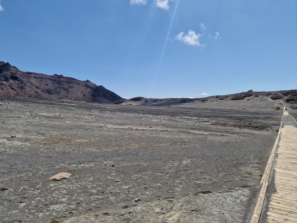
After the pass I went down to visit the Tadewara wetlands. The wetlands was one of the spots I was looking forward to visiting, but I hadn’t read much about it, and they burn the place down every spring! This is to keep the wetlands a wetland, and not to let it be overgrown by other plants that don’t belong there. So all I got to see was a newly burned flat area.
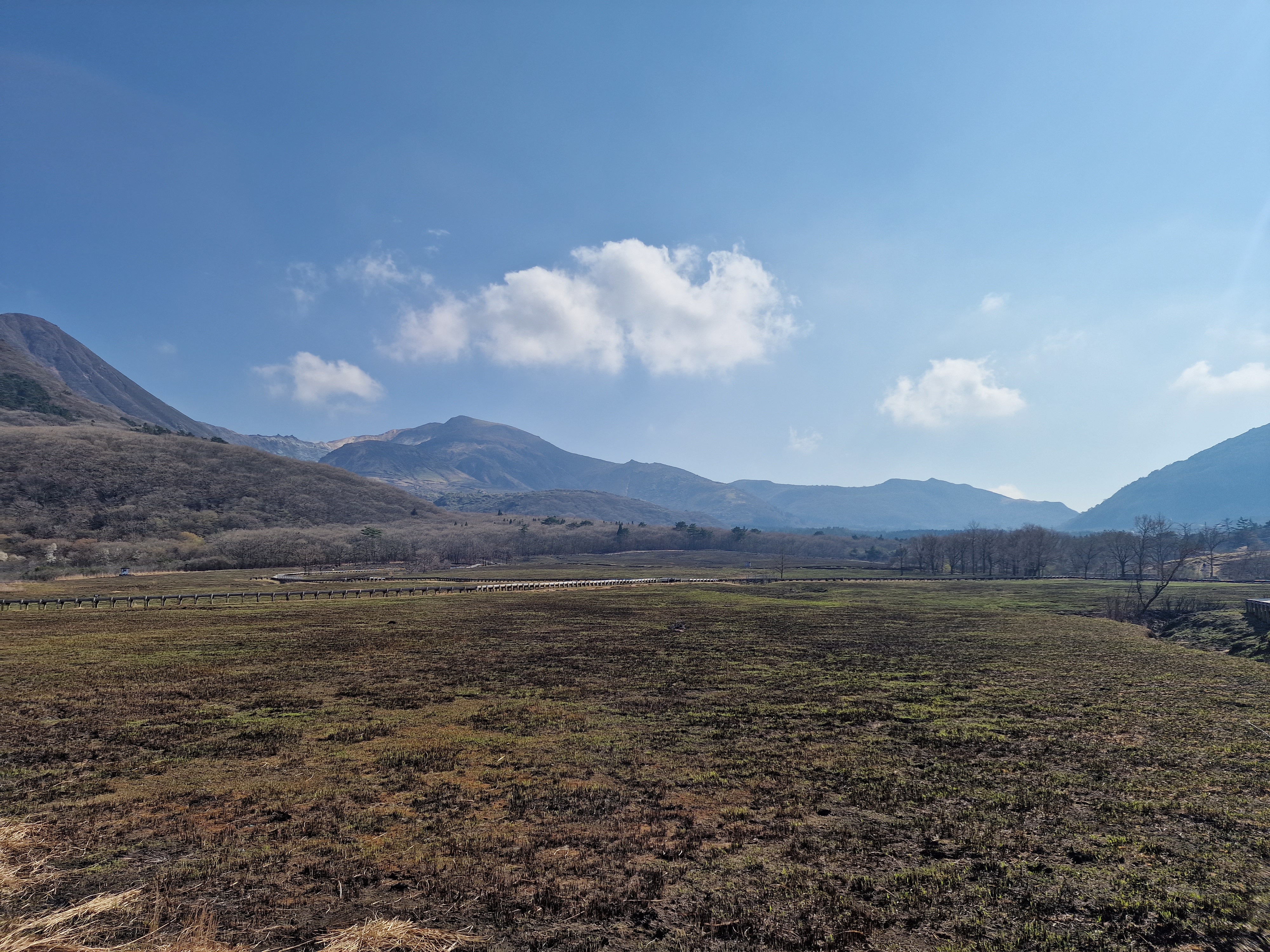 It looked more impressive on the photos, the correct season is important for this
I had originally planned to camp up here, but found Kuju Aid Station where you can sleep in old railway cars! Forgot to take photos from it, but it was really cool, and the owners even made vegetarian breakfast and dinner for me the two nights I stayed! That was really nice of them! I can really recommend sleeping there, but be aware that it’s old and worn out.
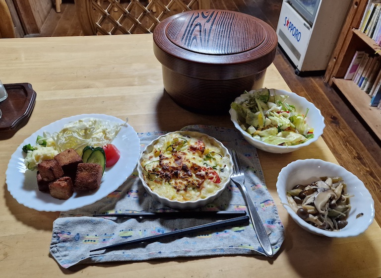 It was good to eat home cooked food for once
Day 10, 18km, 970m - Hiking the Kuju mountains tops
The day started with light rain and low cloud cover, but the forecast looked really promising. The nice lady at Kuju Aid station didn’t want me to stand in the rain waiting for the bus, so she drove me to the next bus station that had a roof, which was really nice of her. When I got up to Makinoto pass the clouds were still thick, with poor visibility, but at least the rain had stopped.
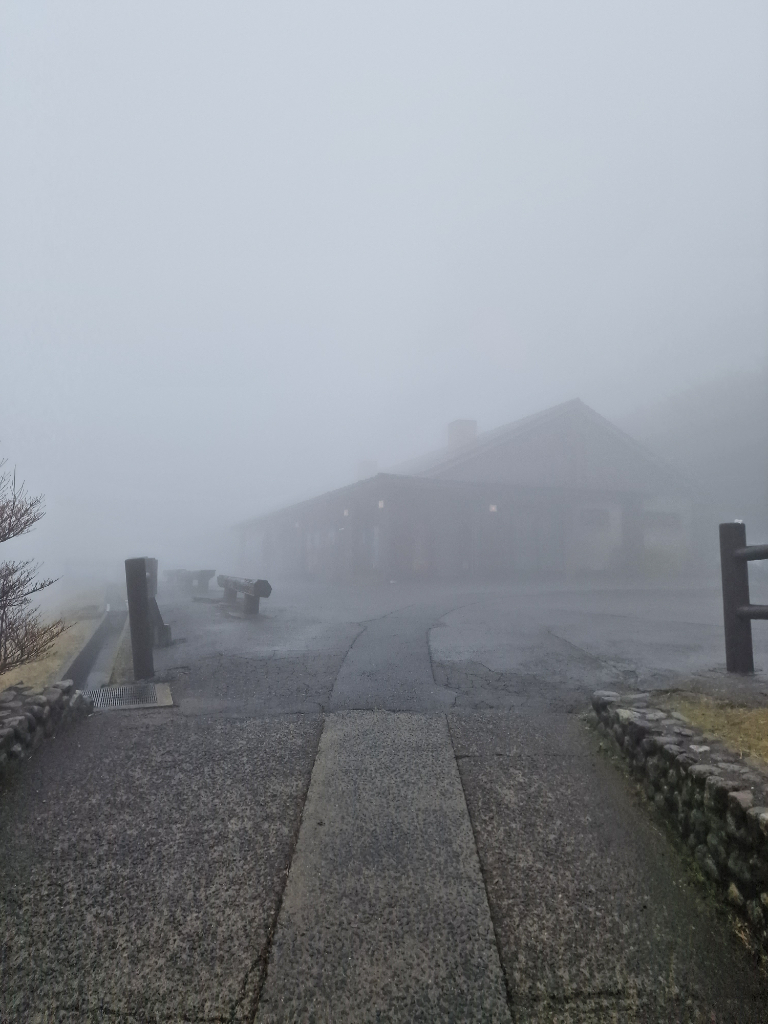 It was adventurous to start the hike in such a thick fog
Another hiking day, this time the goal was getting to the top of Kyūshū’s highest mountain, Nakadake, 1791m! It was a rather easy hike, and the forecast was correct - the clouds cleared, and the view got pretty good. Sadly there was a lot of sand dust in the air (someone I met said it was from Chinese deserts), meaning I couldn’t see very far. The original plan was to go to Nakadake and Kuju, and then take the bus going back, but since the weather turned out so good I decided to visit all the tops in the vicinity and walk back home instead.
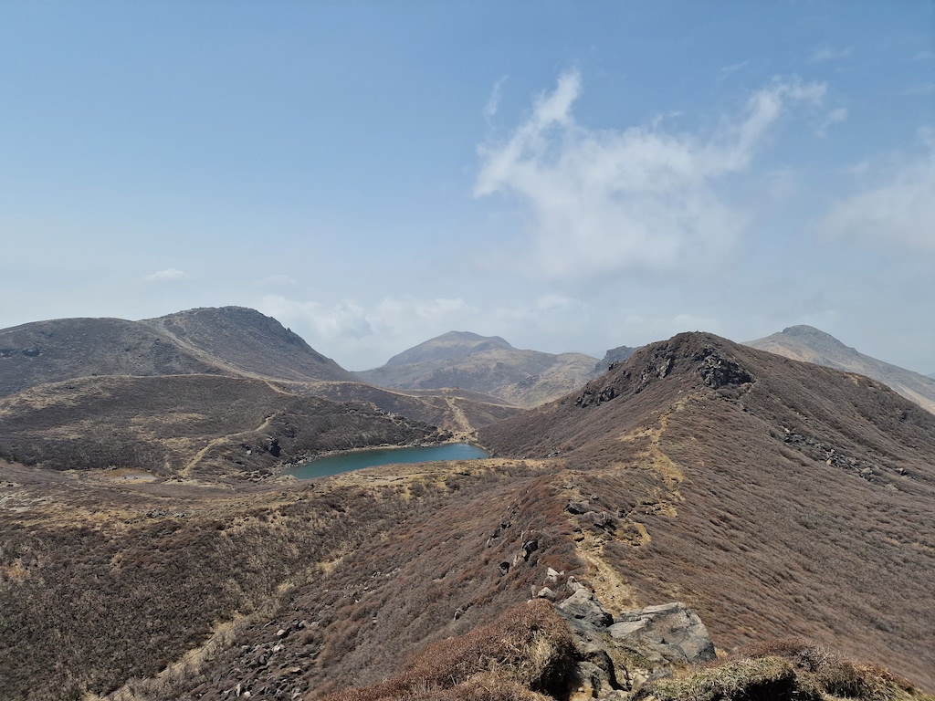 It was easy to find the hiking paths
Instead of going down the same way I came up, I had seen a large cabin that had an onsen in the same direction where I was staying for the night. The Hokkein Onsen Sansou reminded me a lot of the cabins from The Norwegian Tourist Association. I was the only one visiting the onsen, and the place, so I sneaked in a beer from the vending machine outside. It wasn’t the best onsen, as the bottom of the pool had a lot of loose paint flakes, and it all swirled up when I stepped into the medium heated pool. Still, it was nice and relaxing.
 When I took this photo I didn’t know I would be hiking out that valley
The return trip took me first back to the wetlands from yesterday, and to the Chojabaru Visitor Center, where I managed to hitchhike back to Kuju Aid Station from one of the workers who was done with her shift.
Day 11, 51km, 570m - The end of the road (Beppu)
On day eleven, two days earlier than planned, was the last day of my trip. I had mixed feelings about it - on one hand it would be nice to finally stay in one place for a bit longer, and not hop on the bike the next day. On the other hand I would miss seeing new things every day, and also having an easy plan to just bike to the next place. Other than the fact that it’s hard to bike several days in a row, it is a wonderful way to explore a new area. You can easily stop whenever you want, and you’re not going so fast that you can’t enjoy the scenery on the go.
 A beautiful tourist road going up before I could coast down to Beppu
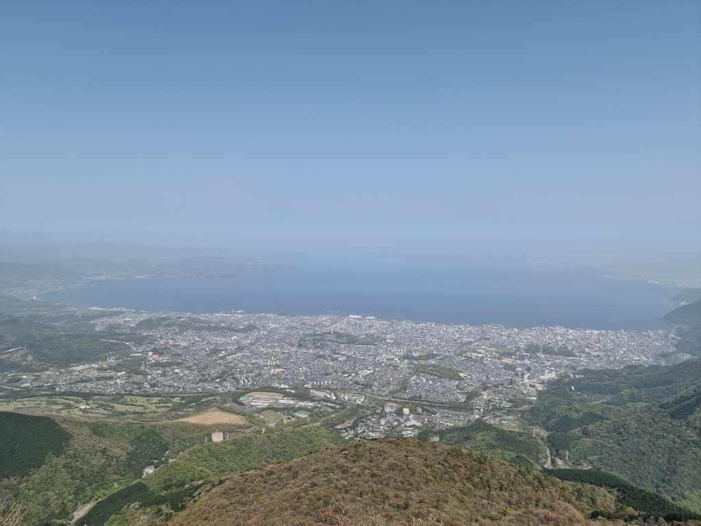
It’s wasn’t the shortest distance of the trip to ride, but it was the least climb, which was nice! I decided to cycle the tourist road south of Mount Yufu, and took the Beppu ropeway up to Mount Tsurumi. This route gave me a great view of Beppu, and a little bit of Oita.
On the way I stopped at Kyu Hino Iin (or Hino Clinic), which was an old hospital run by a female doctor if I understood the tour guide correctly. It’s not often I go with a tour guide, especially one that only speaks Japanese, but I was the only one visiting, so I guess he felt the need to tag along and try to explain everything to me. It was interesting to see the western influence on this building and the art inside of it. If you’re nearby, you should visit!
After being on the road for two weeks, and cycling about 640km and 10 000m of elevation I was finally in Beppu!
 You can just make out Oita in the distance
In Beppu city
Since I arrived two days earlier than planned I booked a hotel in the old part of the town. Which I’m glad I did, since it was a lot more to see and more cozy up there than down in the city center where I spent my last night and day.
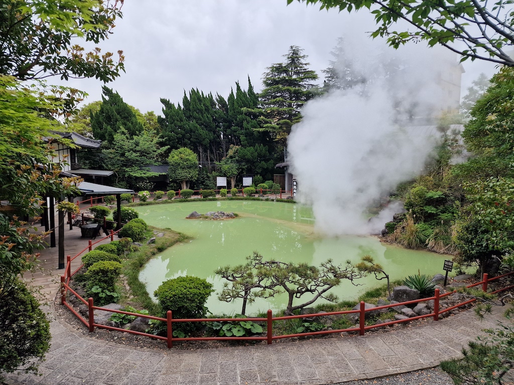 One of the seven hells where the pool was green, other colors where red, gray, brown, and different shade of blue
I got to visit the seven hells (Jigoku), bathe in a mud bath (more like mud water), visit a monkey temple where they feed monkeys to keep them from stealing food from the farmers in the area, and tried park golf! Park golf is kinda like normal golf, except that you only have one club, and the course is a lot smaller. It was really fun to try, and something I hope to play more next time I’m going to Japan.
 The view from the course was really nice
I also visited some onsen, but after bathing in onsen nearly every day for two weeks, that wasn’t the most exciting thing to do for me. At least I got to try two private onsen, so I could bring my book to read.
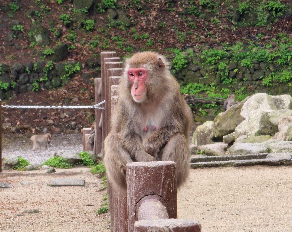 One of the 1000 monkeys that lived in the hills outside Beppu
My gear
I went for a kind of lightweight setup, so it will probably not fit everyone.
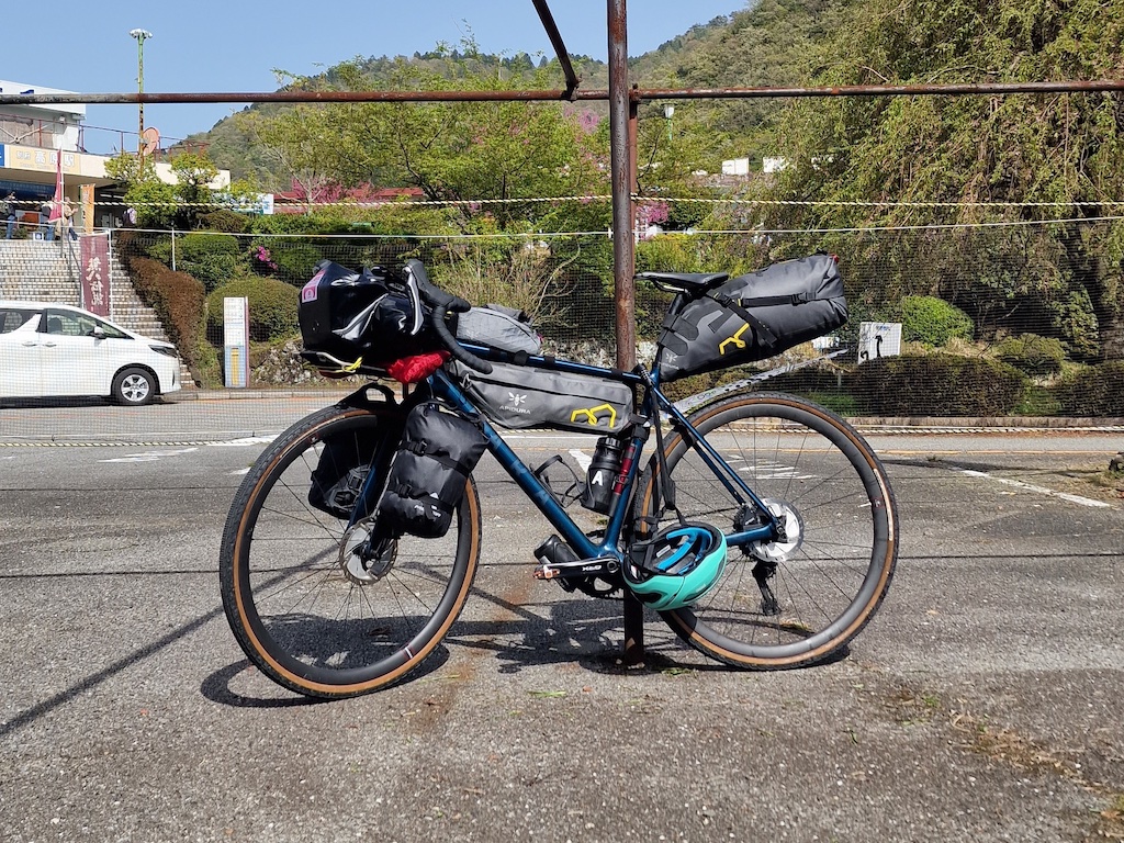 My Fara gravel bike, it’s a blast to ride
Seat post bag
- Sleeping bag
- Spare cycling kit in the bottom
- Light hiking shoes on top
- Tent poles (in the beginning)
- Cycling rain jacket
- Fleece
- Simple bike lock (mostly a requirement from my insurance company)
Half frame bag
I also had two 0.6l water bottles in my frame, plus a bottle for bike tools underneath.
- Passport
- Credit card
- Charging cables and adapter
- Headlight (needs to be changed for one that fit my helmet)
- Battery bank (30 000mah/111wh, which was too big)
- First aid kit
- Tissue paper (never used, convenience store always gave me wet wipes)
- Spectacle case (I wear glasses)
Right fork bag
- Rest of the tent (MSR Hubba Hubba NX 2 person)
- Room for food
Left fork bag
- Sleeping mat
- Clothes maybe needed through the day
- One pair of Black Diamond climbing pants (perfect for bikepacking, they are comfortable and look stylish)
Big handlebar bag
- Two spare tubes
- Change of clothes
- Two pair of wool boxers
- Two pair of wool socks
- One pair of thick bike socks (too warm for Kyūshū in April)
- One pair of cotton bike socks
- One Northern Playground grandfather shirt
- One Northern Playground hooded shirt
- Wind breaker
Small handlebar bag
- Nook ebookreader
- Snacks
Top tube pack
- Mobile phone
- Snack
Cycling kit
- Pedaled wool jersey
- 7mesh cargo bib
- One pair of Pedaled wool bike socks
- Quoc Gran Tourer Black Gum bike shoes
The bike
- Fara Gravel Adventure 2020
Afterthoughts about my gear
I should probably have brought legs instead of knees as part of the cycling kit. Since if it first got cold, it didn’t help that much with just knees. Arms wasn’t that useful either, especially since I had a fleece, rain jacket, or long sleeves to put on when it was cold.
My Northern Playground shirts were really nice to have. They are good at keeping warmth, but also not getting too hot in the sun. Should probably have had one with a high neck instead of the short neck one.
Having two pairs of gloves was also really nice, one short and one long. The long pair was also nice for the hikes I went on.
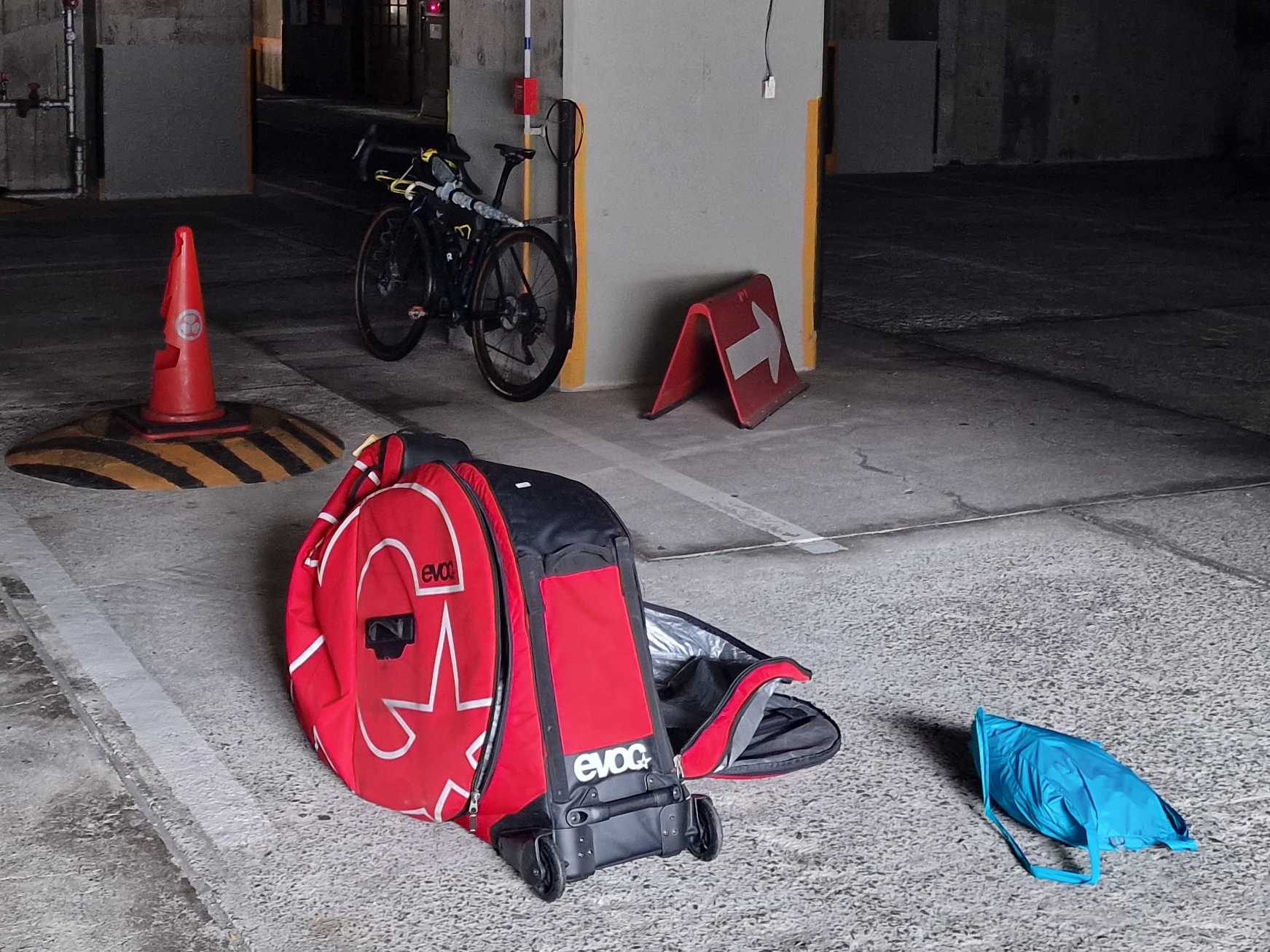 Was sent down to the parking garage to pack my bike in the dark